Projects
Shaping growth through precise surveys & practical planning.
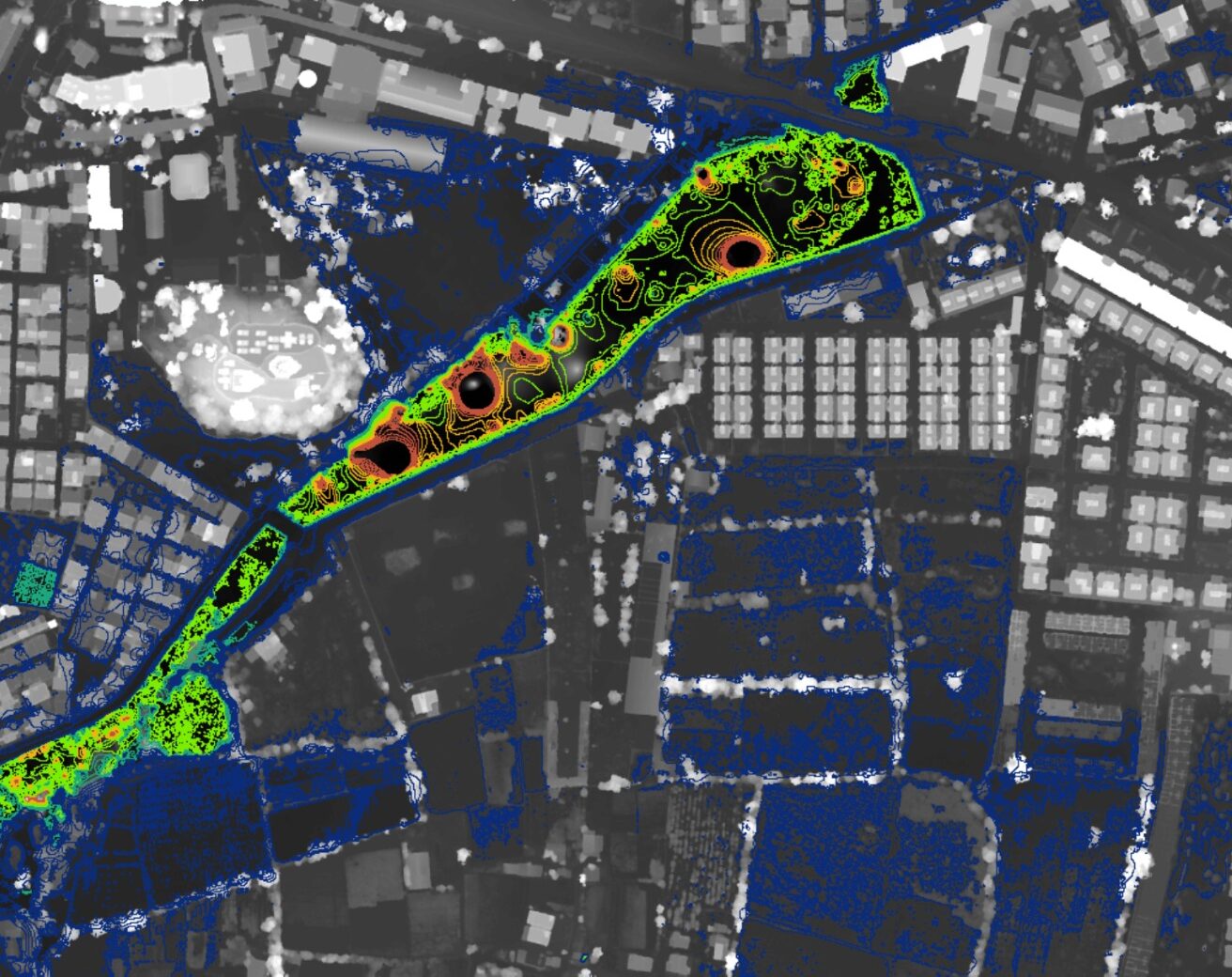
Every assignment we take on is built on accuracy, clarity, and implementable outcomes. From city-scale Development Plans and Town Planning Schemes to corridor surveys, land acquisition plans, and UAV-based topography, our work supports governments, industries, and developers with solutions that actually move projects forward.
- Diverse portfolio across urban, industrial & infrastructure projects
- Development Plans (DP) and Town Planning Schemes (TPS)
- Road networks, corridors and infrastructure layouts
- High-accuracy land, topographical & UAV drone surveys
- Land acquisition plans and alignment studies
- GIS mapping, analysis and planning decision support
Explore some of our work across planning, surveying, and infrastructure development.
Our projects range from Development Plans and Town Planning Schemes to UAV surveys, road network designs, and land acquisition studies—each delivered with accuracy, clarity, and long-term value.
Development Plans
Mandvi, Gujarat
Hybrid Survey - DGPS + Drone Survey
Ahmedabd Metro, Gujarat
Town Planning Schemes
Nadiad, Gujarat
Land Acquisition Work
Dhandhuka, Gujarat
Move your project forward with Benchmark.
Benchmark partners with public agencies, consultants, and developers to deliver clear, implementable planning solutions. With precise surveys, regulatory understanding, and structured documentation, we guide projects smoothly through every stage—from initial studies to formal approval.